I have really come to love the Kananaskis region over the last few years of visiting the Canadian Rockies. Located less than an hour drive outside Calgary, Kananaskis Country is a collection of stunning mountain parks, known for being the outdoor playground for the locals. Fewer tourists frequent this area, as it is often overshadowed by Banff, Jasper and Yoho National parks. For this reason it is way easier to find parking, there is almost no traffic, and the trails are less frequented, giving a better chance of a backcountry feel.
Some things to note about the region: there is almost no cell service, so bring a satellite phone, especially if you are travelling alone or meeting people. (Always have a designated meet-up place if you are meeting fellow hikers). Also, it is wise to bring a GPS, as some parts of the trail are a bit tough to find. I used the GAIA GPS app on my phone. There is a lot of bear activity, so bring bear spray, and remember to have a group of four or more on some of the trails. Tent Ridge is a more popular trail, so if you do go alone there are chances to meet up with other groups. Bring plenty of water and food, as you will most likely be out there for most of the day. And, leave no trace!
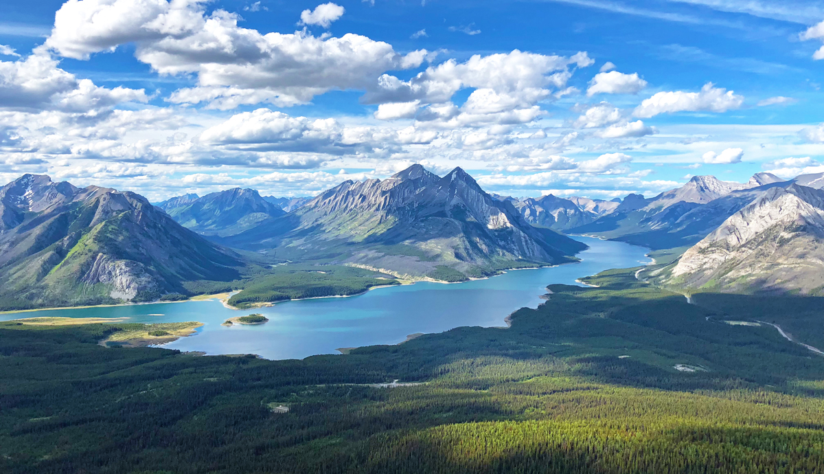
Tent Ridge is located in Spray Valley Provincial Park, and gives one of the best views of Spray Lakes in the region. The hike gives views of larger surrounding peaks, the valley and other lakes. This hike itself is only 6.8 miles, but allows for the summit of three peaks and ridge walking. I would rate this hike (on my personal scale) as easy-moderate, as there is some scrambling involved. However, it is not a hike for beginners. There are places where I saw people turn back because their fear of heights or climbing took over.
I was coming from Canmore, and made plans to meet a friend at the Mt. Engadine Lodge, a common meet-up spot for hikers in the area (Remember, there is no cell service). I got my breakfast at Tim Horton’s, my usual vanilla-dipped donut with an orange juice, got my go-to lunch at Subway for the trail, and headed out. From Canmore, it’s an easy drive to the lodge. Take the Smith Dorrien Trail (Spray Lakes Road) all the way down until you see the sign. Make sure to have time to stop and enjoy the views of the lake!
We ended up parking at the lot across from the trailhead. To get there from the lodge, take the road across the bridge and drive up a bit. On your right there is a parking lot, usually full of hikers.

We were advised to hike Tent Ridge clockwise, as the scrambling ascent is much easier and safer than descending it. As well, the views are “better” of the lake going clockwise, as you are always facing it.
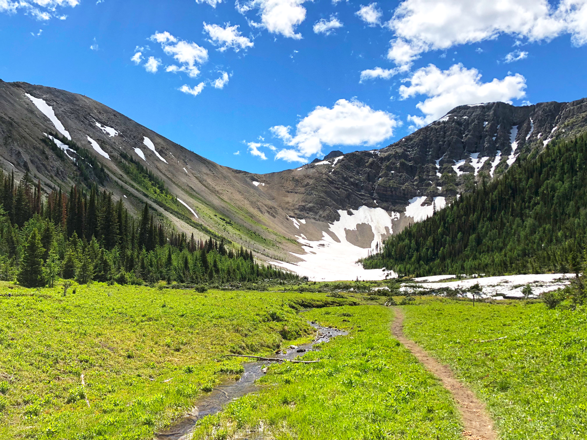
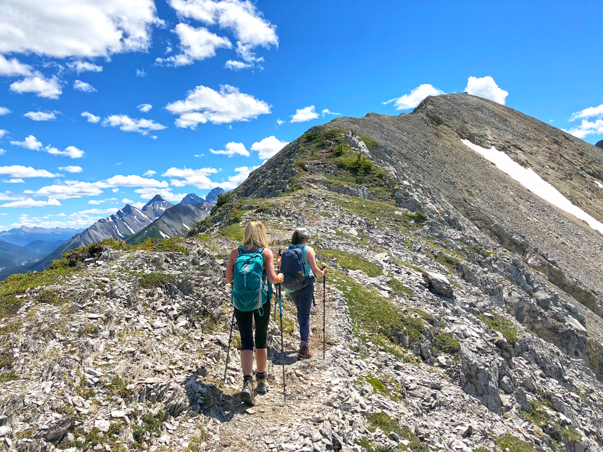
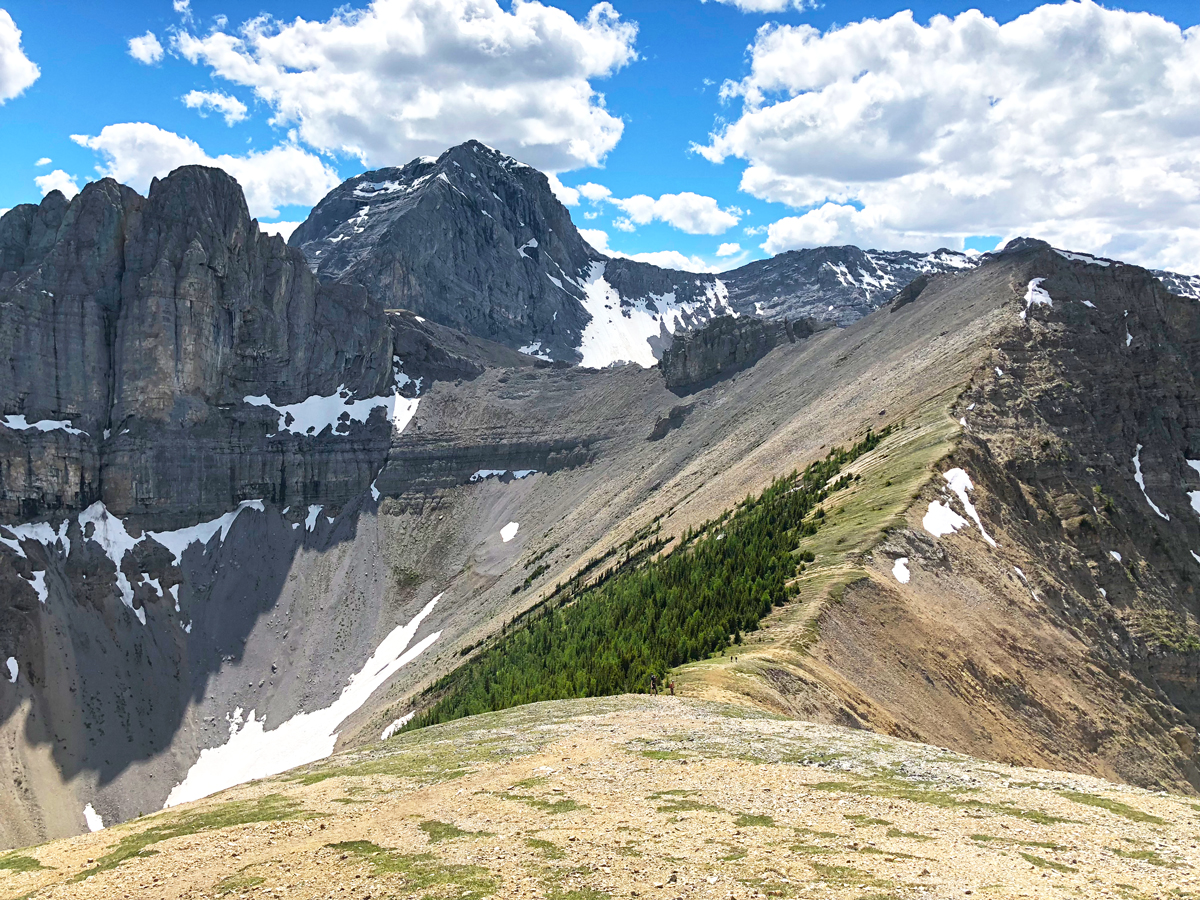
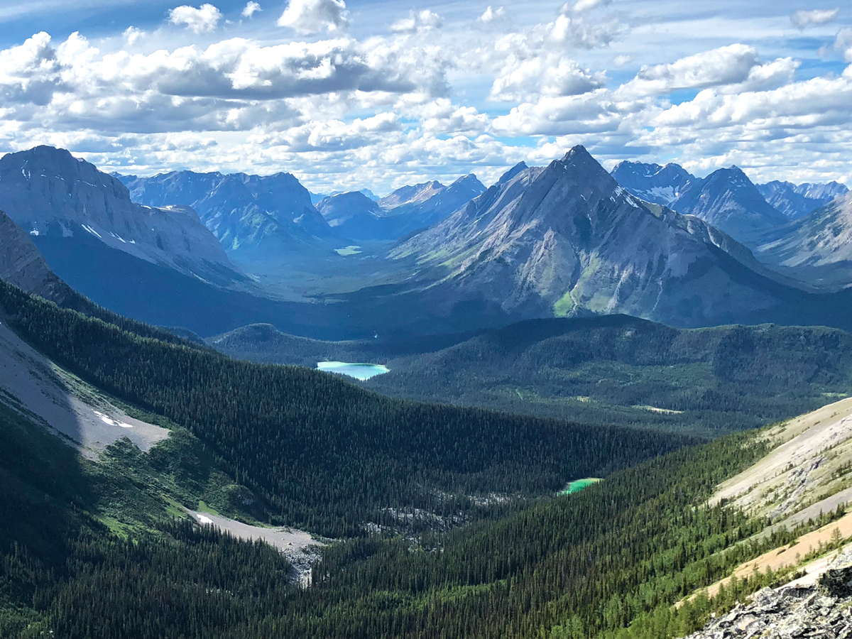
The trail begins in the trees, and eventually leads to the open meadows, where you can see the destruction from a previous avalanche and the ridge above. The landscape is so green here; it really contrasts with the surrounding mountains. The trail is for the most part easy to find, and there were lots of people around to follow. There were a few spots where I checked my GPS, as there are a few forks in the trail. After hiking for a bit we took a left and ended up at the ridge.

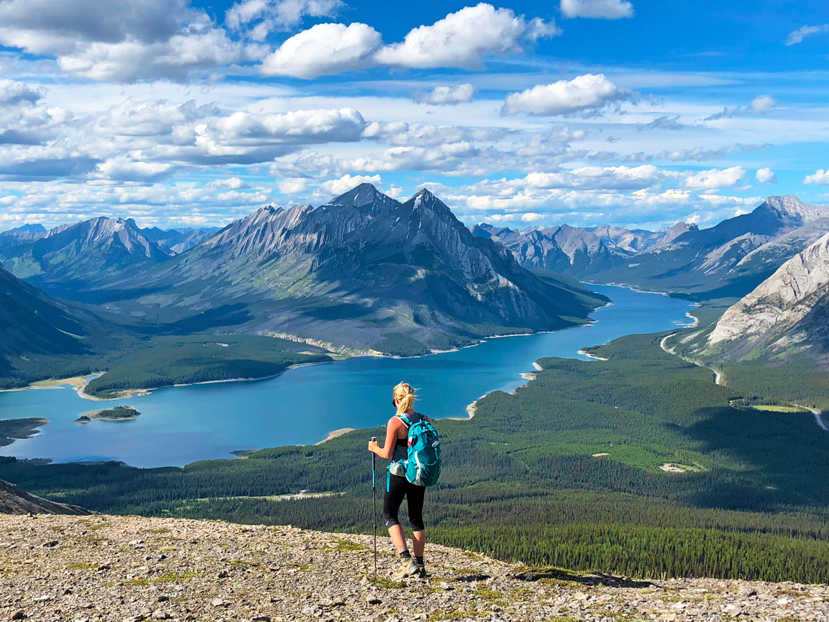
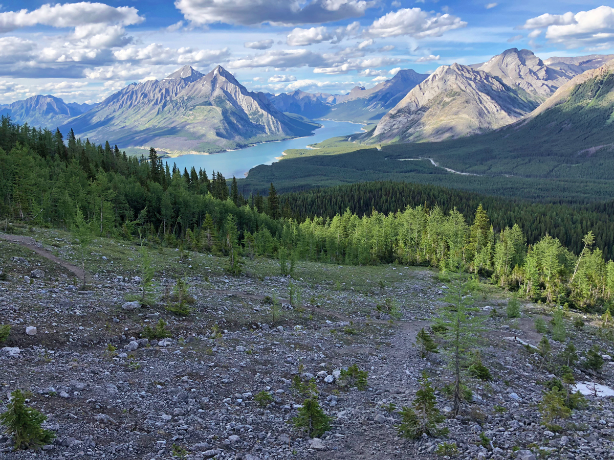
Here we started walking up a trail, mostly scree. There was still a bit of snow on the trails, but it was easy to navigate as it had been worn down. It was moderately steep, and started to offer views of the Spray Lakes reservoir that this is well-known for. Remember to take a few breaks on the way up to look back and take in the views as you continue the climb. There is some scrambling at this portion of the hike, and this is the part where we saw a few people head back down. They thought it looked too exposed, and too steep. If you do not feel comfortable here, do not hesitate to go down. The mountains can be a dangerous place, and it is better to be safe than hurt, or worse.
We felt more than ok, as we have scrambling experience, to continue on. In my opinion, the scramble looks a lot more difficult than it really is. There may be a few parts where you need to use your hands to steady yourself, but all-in-all I would say anyone can do it as long as they are mindful.
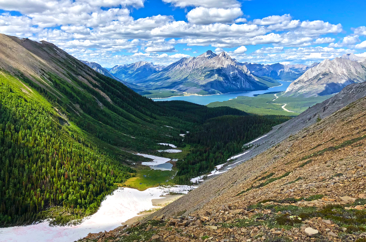
As you continue on the ascent you will start to see a weather station at the first peak. We chose this spot to have lunch, as it offers incredible views of the lake below and the surrounding mountains. After taking lots of photos, we packed up and started towards the second peak. We descended down a scree path and began our up yet again.
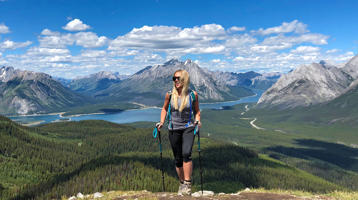

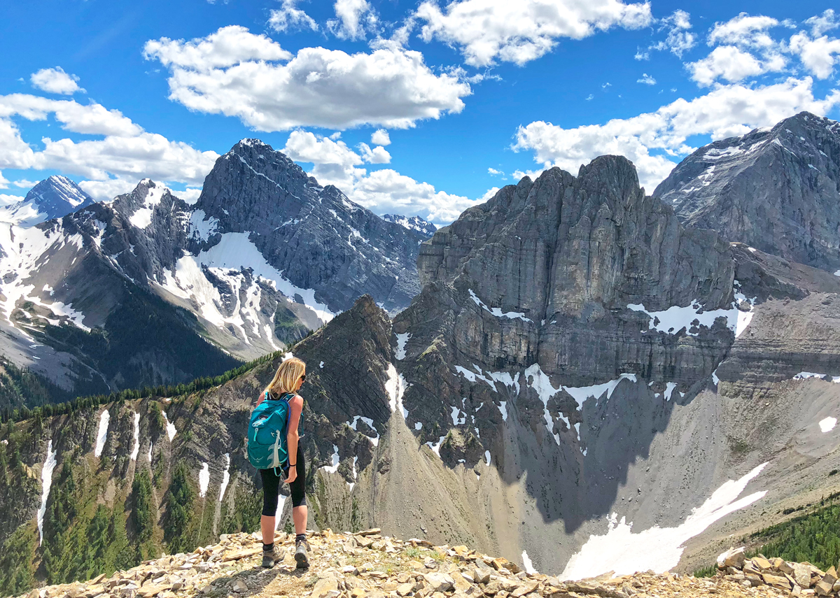
The second peak, the actual summit of Tent Ridge, is the highest peak and presents a relatively steep climb up. We had to descend the first peak and then hike up some scree to get there. There are great views up here, and you can start to see the landscape of the Assiniboine region in the distance. We took a break here for photos (ok, lots of photos) and then headed towards the third peak.
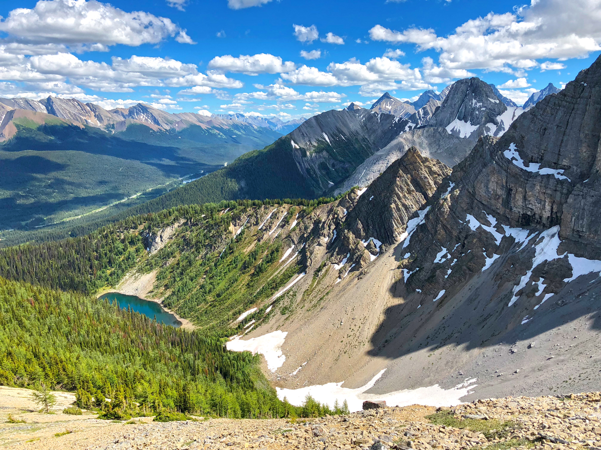
It’s easy to get off the “path” in some parts of the descent. Luckily we encountered a few other groups who knew what they were doing.

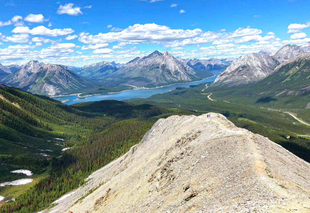
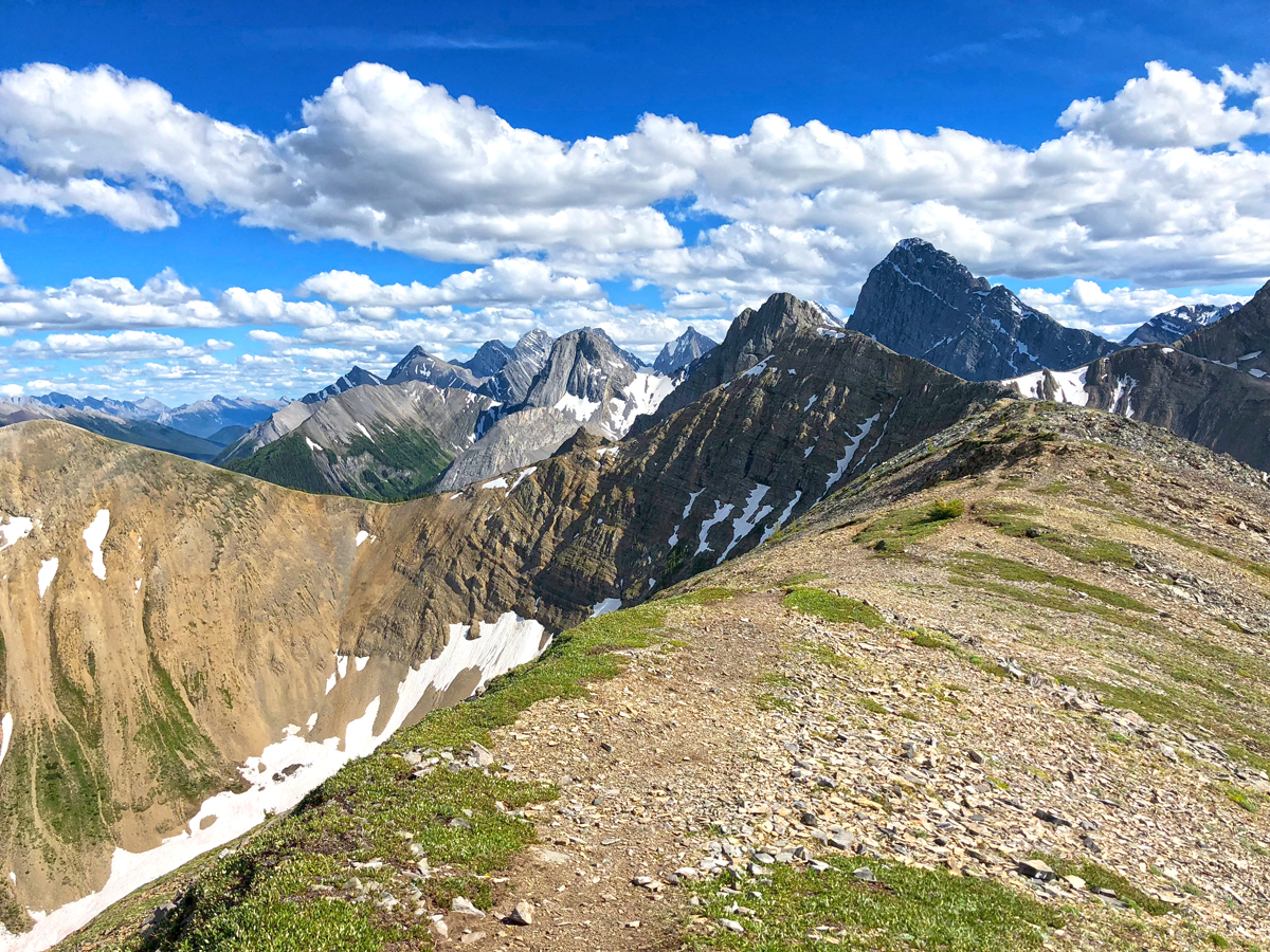
The ridge walk to the third peak is absolutely stunning. The whole time I just kept thinking: “is this real?” It truly looks like a painting. (Note: Some people just come up to this peak from the parking lot and don’t do the whole hike. If you are short on time or don’t want any scrambling, this may be the option for you). Once we got to the peak, we were rewarded with the best views of the entire hike, and in my opinion, one of the best views in the entire Kananaskis region.


Now for the final descent. This is where we screwed up a few times. The initial descent (some fun scree-skiing) is easy, and the trails are easy to follow. It was when we encountered the beginning of the tree line that we had a problem locating the path. I believe someone stated that there was previous avalanche damage. Fending off tons of mosquitoes (seriously, where the hell did they come from?), we ended up making friends with a lost group and decided to just make our own path. We eventually found the path out, and fending off mosquitoes with our trekking poles, made it to the car. In good time too; we pretty much ran the rest of the way down.
The end of the trail leads right back to the parking lot, and it was time to get back for a shower and good meal. On the way back to Canmore I stopped quickly at Spray Lakes, just to see it from a different perspective. The sun was beginning to set, and it was a darker shade of blue, much different than the vibrant blue I saw on my drive there. That’s what I love about the Canadian Rockies: the landscape seemingly changes as the day progresses, and it blows my mind every time.


Founder and main contributor to This Adventure Life, Kirsten Alexis has passion for all things adventure and the outdoors. She is an avid participant in action sports, such as skydiving, paragliding, snowboarding, high-altitude trekking, mountain biking, surfing and more. She is passionate about inspiring others to live their wildest dreams as well as conserving the environment for others to enjoy for years to come.